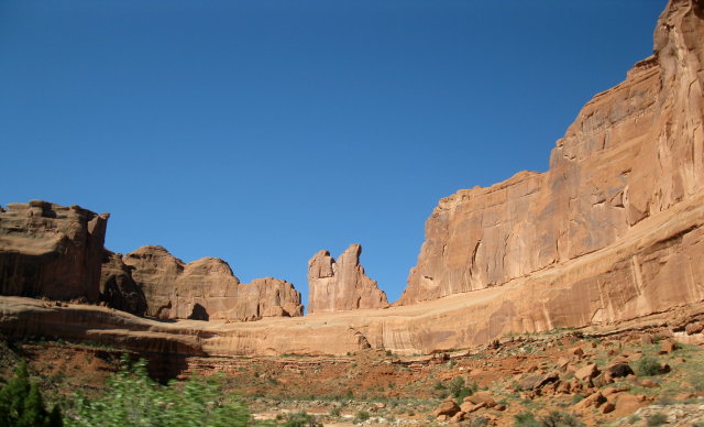
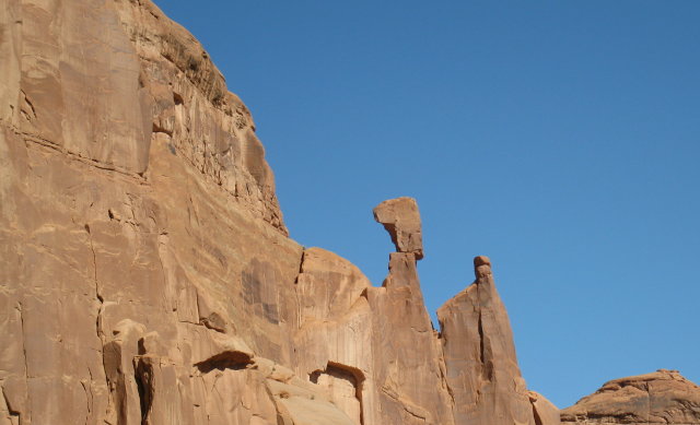
This park is truly magnificent. Huge sandstone walls, towers, mesas and all other shapes abound. You can see a layer under the largest sandstone layer that is crumbling badly. Gives rise to all the shapes, many of them looking quite precarious. We did a little walk to see Delicate Arch, the one Utah uses on their number plates. At this altitude it was quite difficult for us sea-level dwellers.
Then it was back to Moab for a refuel and we headed out on a road Ken had picked out last night. Turned out this was a very scenic route that followed the Colorado River. This ancient stream had cut hundreds of metres into the surrounding sandstone and the walls of this canyon, named Hal Canyon were huge.
We followed this for quite a while until it made it's way towards I-70, which we turned onto. This is a major highway and the trucks run at very high speed. We needed to keep up to the 75mph speed limit to avoid being overtaken and buffetted off the road. While dicing with one, we almost missed the Welcome to Colorado border sign. A bit of reversing ensued, and the requisite pictures were taken.
We soon stopped in Fruita for a coffee then entered another park, Colorado National Monument. This is a road built into the side of a large canyon, a project of the depression years last century. They did a great job, and more recent upgrades have made it in to a spectacular - if a little scary - ride overlooking the surrounding countryside.
After that we all got a little lost in Grand Junction. They've built new roads since our maps were produced. By the way, Ken was leading today and has proved to be a bona fide Wing Rider, leading us to at least three U-turns for the day.
A late lunch and we finally headed out of Grand Junction only 12 miles of I-70 and we turned off onto Hwy65, also known as Skyway. A good name too. We reached a new record (for us) height of 10879ft above sea level. A good 320 feet higher than previous.
Climbing up the hill, we paused at a pullout for a scenic view. A local law enforcer was there talking to someone else. As we pulled out, he took a look at Ken's bike and ran for his car and chased him down. First time we have been pulled up for Ken having no number plate. They had to unpack the topbox to get the papers from the bottom that showed it was a hire bike and no plate had arrived for it yet. He was a nice policeman and let us continue on.
After checking out the wonderful scenery from the top of the Skyway, we ran down the other side and still had another 80 miles or so to go to Carbondale. Over another pass we went on Hwy 133 and we raced a very fast moving stream all the way in to town.
Finally checked in to our motel after 6:30pm after a very long and very spectacular day.
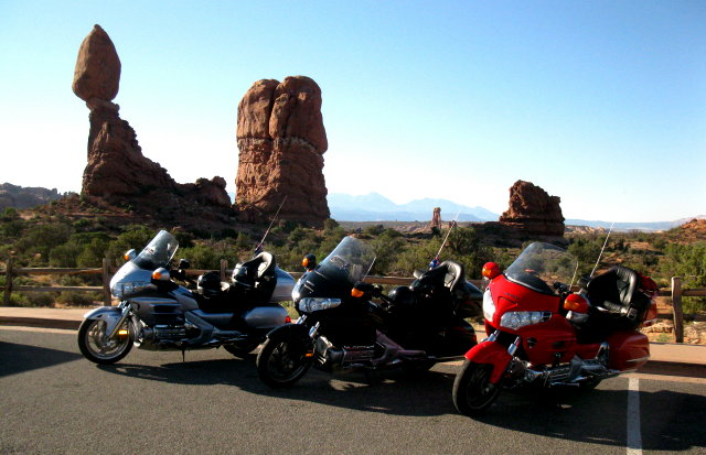
Take a look at these:-
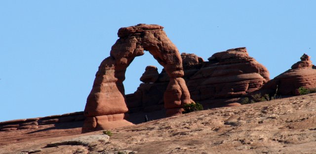
Delicate Arch - seen on all Utah number plates
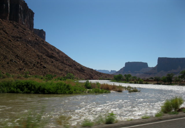
Colorado River is well swollen with snow melt
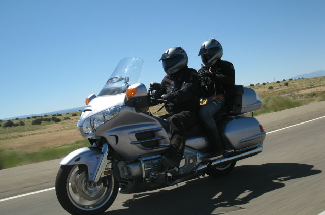
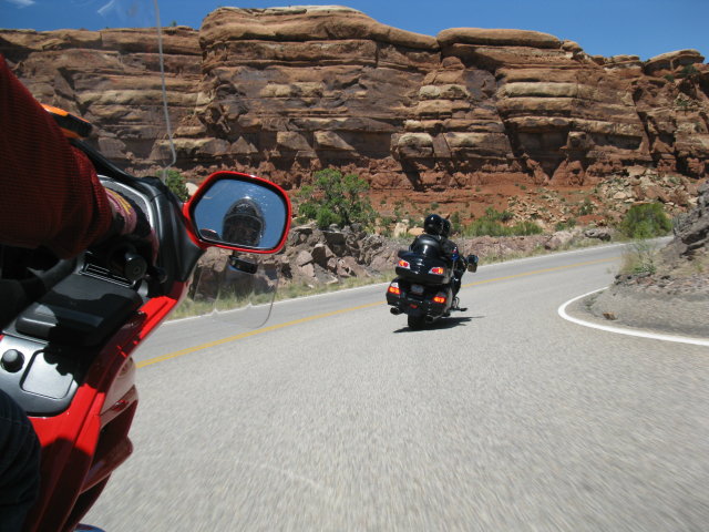
Ken and Christine going 75mph
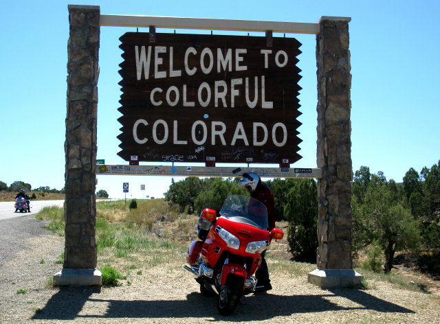
A new state for us
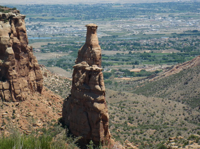
Independence Monument in Colorado National Monument
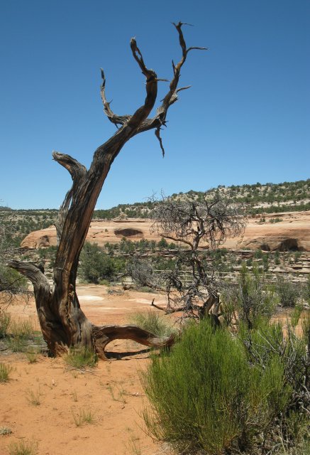
The stark beauty of deserts
Chasing Bob down through the curves
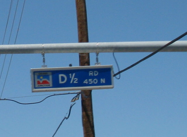
What to do when subdivisions are not well planned. There was even a D5/8 Rd
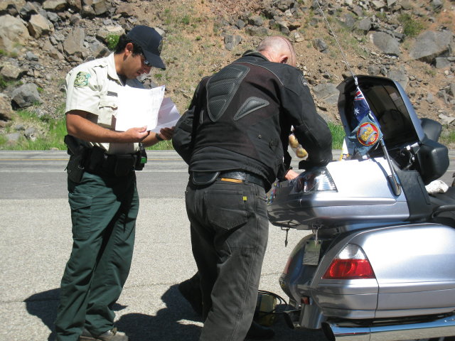
Ken has some 'splainin' to do.
No comments:
Post a Comment